
Photo: Matthew Hinton, AP via CNN
By Alexandra Patel and Monica Medina
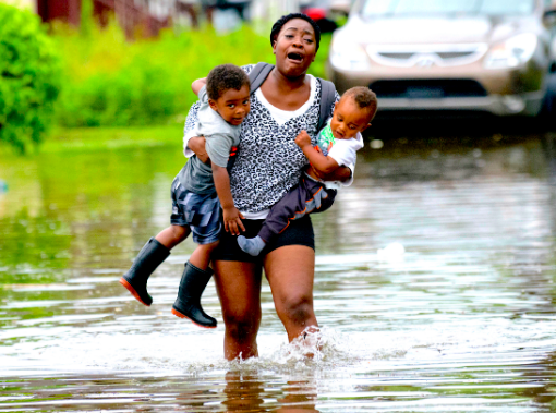
On Wednesday, New Orleans got a preview of coming disasters. Severe thunderstorms that dumped between 6 and 7 inches of rain on the city in just 3 hours prompted tornado warnings and inundated the downtown area with water, causing transportation snarls and even forcing City Hall to close. Just as government forecasters announced that they expect 2019 to break annual flood records nationwide, the first real storm threat of the season “Barry” is lurking in the Gulf of Mexico setting its sights on the Louisiana coast (possibly New Orleans) but it is still not clear where it will make landfall.
- In New Orleans, the biggest concern is the already floodwater-swollen Mississippi River and the communities surrounding it.
- According to current models, storm surges on Saturday could elevate the river up to 20 feet above sea level – a height will mean water reaching the top of levees in some areas bordering the river or worse.
- There is potential that the river will overtop the levees and flood the surrounding neighborhoods.
- The Army Corps of Engineers, which built and maintains the levees and flood control systems, says they are not expecting widespread overtopping of the levees in the city of New Orleans, but they are watching areas south of the city closely, according to CBS News.
Why This Matter: According to a report by the National Oceanic and Atmospheric Association, “Annual flood records are expected to be broken again next year and for years and decades to come from [sea-level] rise.” The average number of days with such flooding could reach 7 to 15 days a year by 2030 and 25 to 75 days a year by 2050 – a stark contrast from the five days in 2018. This weekend’s severe storm threat to New Orleans should not be treated as a rare event, but instead as a glimpse into the future. As sea levels to rise, coastal flooding risk and the threat it poses to communities will continue to ramp up. To mitigate these dangers, not only must steps be taken to implement effective storm and flooding protective measures in the short run, but also to address the underlying issue – rising sea levels and more frequent extreme weather events as a consequence of the climate crisis that we can expect from now on.
Enough Protection? Along the Mississippi River, many of the levees built to prevent the overflowing for the river stand at heights below 20 feet, some even as low as 18 feet. This was supposed to be tall enough to keep the worst from happening again. But unprecedented elevations in Mississippi River levels and the expected storm surges from Barry could cause overtopping on the east and west banks along the Lower 9th Ward – something that has never happened in New Orleans’ modern history.
The New Normal: Already, New Orleans is having to deal with flash flood emergencies, as rain preceding the storm brought the streets nearly an entire foot of water on Wednesday. The city was at a standstill, as many could not commute or even leave their houses. While New Orleans is no stranger to floods and the federal government spent handsomely in the last decade to upgrade storm protections – $14.6 billion since Hurricane Katrina – the city is dealing with the double whammy of exceptionally high river levels after a record year of rainfall and the impending coastal storm. Compared to the 3 foot high river Katrina hit in 2005, Barry will be approaching the Mississippi River as it sits at 16 feet – a dangerous set up for a potential weather disaster.
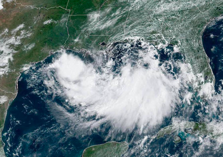
NOAA satellite image of Barry
July 11, 2019 » Corps of Engineers, flood, hurricane, levees, New Orleans, severe weather, storm surge, tropical storm
