
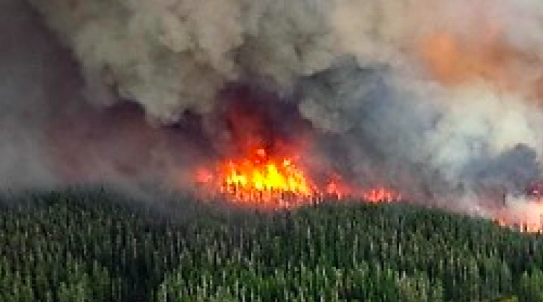
The firefighting community in Los Angeles has spent the last 18 months testing a program developed by the WiFire Lab at the San Diego Supercomputer Center that can predict in real time where active fires will spread next, which is particularly important in dense urban areas. The New York Times reported on a new computer program, known as FireMap that “pulls together real-time information about topography, flammable materials and weather conditions, among other variables, from giant government data sets and on-the-ground sensors” and then those maps can be sent electronically to incident commanders on the ground so that they can appropriately deploy firefighting resources.
Why This Matters: This is a real step in the right direction so that fighting fires is as sophisticated as preparing for severe weather – lives will be saved as a result. And it is fantastic that it is being pioneered in Southern California, but all the areas of the country that are at serious fire risk should have the same capacity. Fire “prediction” is fundamentally a government responsibility and this is the kind of service that will be increasingly needed as the climate crisis increases the risk of fast-moving forest fires. The Washington Post has warned that the wet winter we just had in California has created more fuel for wildfires when soaring heat this summer “scorches” the new growth. We need to use new technology to help us be better prepared for climate risks — not just in California, but everywhere.
Computers Can Do It Faster – Just Ask Weather Forecasters.
- The Times explained that the “program can make sophisticated calculations in minutes that would take hours to run manually, said Ilkay Altintas, the chief data science officer at the San Diego Supercomputer Center.”
- “The algorithm takes into account forecasts from the National Weather Service, vegetation readouts from the United States Department of Interior, and even satellite data from NASA, among other data.”
Experts say the time saved is key — “Martha Witter, a fire ecologist with the National Park Service in Southern California, said it was crucial to reduce the lag time between when a fire starts and when firefighters can inform the public about potential evacuations” and that is especially true where there is dried out vegetation and dense development. According to The Post, California’s forest managers are setting “controlled” fires months earlier than usual, and they have adopted plans that will allow vast stretches of state forest to burn if wildfires begin naturally. But prevention simply may not be enough, given the heat and dry weather that sucks the moisture out of trees and plants.
To Go Deeper: Check out FireMap here.
June 24, 2019 » big data, California, firefighting, forecast, Forests
