
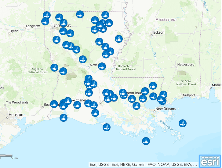
The state of Louisiana’s Department of Environmental Quality starting in December first published an interactive map that shows where it is unsafe to swim and where fishers should not eat their catches, according to an Associated Press story in nola.com. The map provides information on all the state’s lakes, bayous, and waterways and even covers almost 1,200 miles of the waters of the Gulf of Mexico that are under state jurisdiction. The map is a very much needed tool because it turns out there are some serious contamination issues in Louisiana’s fresh and salt waters.
- There are 58 sites where contaminated fish have been caught or the bottom’s too polluted for safe swimming.
- For the Tensas River, which is 83 miles long, the advisory warns that “Long-term fish consumption may cause a health risk” due to contamination with banned pesticides DDT and toxaphene.
- No fish from the Capitol Lake in Baton Rouge should be consumed because it’s contaminated with PCBs.
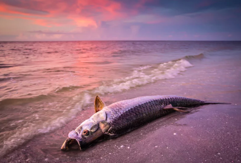
- In the Gulf of Mexico, people are warned not to eat more than a total of four eight-ounce servings a month of fish caught in the ocean as a result of mercury poisoning.
- And also women of childbearing age and children younger than 7 should not eat any king mackerel and no more than one meal (8 oz) a month of cobia, blackfin tuna, and greater amberjack from the Gulf of Mexico.
- Most places restrict eating fish or shellfish and two of those also warn against swimming. Two others warn only against swimming.
The map and its advisories are a result of a collaboration between the two relevant state, the departments of Environmental Quality, Health and Wildlife and Fisheries, who now are working together. Mercury is by far the most pervasive pollutant — and it comes from the atmosphere.
Why This Matters: Warnings against swimming and eating contaminated fish in Louisiana in real time are a huge step forward toward keeping the public safe. The Government developed a system like this for closing areas to fishing during the Deepwater Horizon Oil spill in the Gulf of Mexico. But that went away once the oil spill was over and BP stopped paying for it. Now the public in Louisiana has this information at its fingertips. It would be even better if there were fewer contaminated sites. And this is why the FDA’s seafood inspections matter so much. Many states simply don’t have this kind of system and their residents do not know whether there is contamination. Who knows how fish that is contaminated people are eating? This is the kind of system related to climate change and coastal resilience that the Green New Deal could fund.
To Go Deeper: Click on the interactive Map here.
February 12, 2019 » clean water, Gulf of Mexico, Louisiana, mercury, seafood, swimming
